Fort Humboldt State Historic Park

We decided to vacation in northern California a bit while on the way to Oregon this summer. While very scenic and awe inspiring (think big redwood trees), I was still able to fit in a little history tourism. I had just started the book on Ulysses Grant so we couldn't pass through Eureka without stopping off to visit Fort Humboldt, where Grant was stationed early in his army career.

Fort Humboldt State Historic Park is the site of the fort that was occupied from 1853 to 1870. The fort was built overlooking
Humboldt Bay to provide protection to gold seekers and arriving settlers from the local Native Americans. Captain Ulysses Grant was stationed here for a few months in 1854. At its peak, the fort had 14 buildings arranged around a parade field. For the troops stationed here, the duty was dull and boring.

We visited the park in early June and the weather was still very cool compared to the Central Valley of California where we had just come from. Being the "morning people" that we are, we arrived just before they opened the gate. Actually, it's a good thing we had Google Maps giving us the step-by-step directions, as the signage directing you to the site was not obvious. The gates opened at eight o'clock. The visitors center and the two buildings of the fort that remain were not scheduled to open until nine. We spent an hour and a half walking around the park, starting with a display of logging machinery that is co-located with the fort. The park is certainly well tended, but not well visited by all appearances. We pretty much had the park to ourselves with the exception of a local walking her dog and some high school kids on bicycles that I'm pretty sure were ditching the last day or two of school.

The buildings at the fort are the original hospital and a reconstructed surgeon's quarters. The hospital building has some displays on the history of the fort, but unfortunately they were not open during the time we were there. I guess that the park is staffed by volunteers and they were having a late morning. It was disappointing, but the main thing to see when you visit a historic site is actually the location and the lay of the land. The fort is on a bluff and today the city of Eureka has grown around the bay that the fort overlooks. It is obvious that the fort is defensible with a small number of soldiers (I believe that less than 50 were typically at the fort), and the view allows for easily spotting arriving ships.

Probably the best part of visiting Fort Humboldt State Historic Park is knowing that you are walking on the same ground as U.S. Grant, George Crook, and other noteworthy soldiers from the Civil War period. You also gain a glimpse into what their living conditions were while serving in what was then still a far off place, well removed from the civilization in the East that these soldiers were used to.

Next stop in this little "Grant Pilgrimage" I've got going on will be
a visit to Fort Vancouver, another frontier outpost where Grant served before his civilian hiatus from the army.


NARA's Prologue To End Print Version

I have a glorious week off from Teaching for Thanksgiving, something to be thankful for, surely. It's a great time to catch up on some reading and writing of my own choosing. ;-)

Prologue is the quarterly journal of the National Archives and Records Administration (NARA). It has been in publication since the spring of 1969, highlighting programs and news about NARA. The articles are all based on the holdings of NARA in and around Washington, DC., the regional archives located around the United States, as well as the Presidential Libraries

I have been a subscriber to Prologue off and on for a little over ten years. Needless to say, I enjoy this publication very much. So I was very sad that my Fall issue came in the mail recently with a letter that stated that the next issue (Winter 2018) will be the last print issue. Of course, they will continue to put content on the NARA website, but no longer will I be able to hold a printed copy. 

So along with the letter, there is only a one-line statement on the journal's website that says, "The Winter 2018 issue will be the last printed edition." I did a quick Google search and did not find any news release, there is not even a statement in the NARA news on the archives.gov website. Moreover, I haven't found any statements of shock, surprise, or disappointment. 

I won't go into a lament on the switch from print to online content. Business is business and I'm sure it's hard to keep a print publication like a history journal on a paying basis. Additionally, I am sure that NARA will come up with an engaging way to present the content that was once provided exclusively in the print medium. In fact, their notification letter asks for input on what that content should look like. I'm just sorry to see Prologue (for me anyway) get lost in the flood of online information that comes at me every day. I will miss the print version coming up in my reading stack. Which is where I go to escape that flood of electronic noise at the end of the day. I just thought someone should mark the passing.

Point Reyes and Drake's Bay

It is 308 steps down to the
lighthouse, and 308 back up!
One of our recent day trips was to Point Reyes National Seashore which is about an hour's drive north of San Francisco. We had never been to this area before and were not disappointed with the beautiful views there. Even though it was a weekday, there were plenty of people visiting. There is a nice visitor center there, but really, the star of the show here is nature. Plenty of walking and very little in the way of services. The highlight of the visit is a walk down hundreds of steps to the lighthouse. Unfortunately you have to walk back up!

So what does this trip have to do with history? Well, it's not about the lighthouse, although I do love them. If you look at a map of Point Reyes (Google Maps will do), you will see that the point wraps around a body of water named "Drakes Bay." Remember the story of Sir Francis Drake from elementary school? From 1577 to 1580, Drake and his ship, the Golden Hind, sailed into the Pacific to raid Spanish shipping, with the full
Waysides at the visitor center tell the
story of Drake's stay in California.
consent of Queen Elizabeth I. On June 17, 1579, Drake sailed into this bay on the northern California coast to make repairs to his ship before continuing across the Pacific ocean and eventually home. Drake and his men stayed for thirty-six days and by all available sources had pretty good relations with the local Miwok. Oh, yes, and he claimed the land for England. A brass plate that is believed to be made by the crew was later found in Marin County, along with other archaeological evidence to support journals kept by members of the crew.

The cliffs along this bay supposedly
reminded the English sailors of home.
On the day we visited, the only beach goers on this fairly remote beach was a number of elephant seals. So as not to disturb them, the humans didn't mingle. Regardless, it was a bit of a thrill for me to come to this place. First, there are very few places where you can go in California to see what the area might have looked like when Europeans first arrived. The remoteness of this seashore makes it one of the few. Also, Drake claimed this area for England nearly two hundred years before the Spanish would found a settlement on land that would become California and forty years before the English started colonies on the east coast.
The only visitors to the beach on the day
we visited were some elephant seals.
This makes Drake the first European to claim lands that would become any part of the United States.

Sutter’s Fort State Historic Park

One of my favorite historical fantasies includes the wonder of what certain places in California looked like before the modern world took over. I would love to be able to go back in time as an immigrant to California in the 1840s and be able to experience the sight of the Sacramento Valley before there was a city of Sacramento. Well, a trip to Sutter’s Fort State Historic Park doesn’t make that visualization any easier. The park is located in a quiet neighborhood on the corner of L Street and 28th, just a block or so west of Interstate 80. The fort used to be in the middle of rolling grassland in sight of the American River to the north and the Sacramento River to the west. Now it is surrounded by residential streets of Sacramento, less than two miles from the state capital.

Johann Augustus Sutter left his family in Switzerland and came to America in 1834 to escape debts and gain a fresh start. He was reportedly a huckster with a tendency to inflate his own resume, but by hook or crook he made it to California in 1839. When Sutter saw the land around the American River, he started making plans to build a farming and ranching empire. He sold his plan to the Mexican government of California and not only won Mexican citizenship in 1840, but also a land grant of 48,827 acres the following year. All he had to do was maintain order among the local Indians. He was also authorized to issue land grants and passports to American immigrants to California.

With the help of Native-American labor, Sutter built his fort with adobe walls that were two and half feet thick. The compound was reported to be 425 feet by 175 feet. Inside the fort there were carpenter and blacksmith shops, a gunsmith, a distillery, bakery, grist mill, and a blanket factory. Over the next several years, Sutter welcomed immigrants arriving over the California trail. Many new arrivals went to work for him. Eventually Sutter’s “New Helvetia” would encompass approximately 191,000 acres.

When James Marshall brought the gold nuggets to the fort in1848, Sutter initially tried to keep the discovery a secret. But once word got out, the flood of fortune seekers overwhelmed him and his holdings. Sutter lost his empire faster than he built
it. By the 1850s Sutter’s Fort was in ruins. The site was bought by the Native Sons of the Golden West and the fort was rebuilt in the 1890s. It then became part of the California State Park system in 1947.

Although the park was surrounded by the growth of Sacramento long ago, don’t let that give you the impression that this is not an enjoyable park to visit. And if I was going to recommend a starting point for a California Gold Rush trip, this would be the place, followed by a drive up to the Marshall Discovery site. For one thing, the drive up to Coloma would give you a feel for the expanse of land that was under Sutter’s control, if even for a brief time. The fort itself is a real treat to walk through. It is on par with the mission at La Purisma for the re-creation of the shops. There are plenty of artifacts in each to view as well as a period wagon. Check the park website for a schedule of events. If possible, visit on a day when one of the “living history” events is taking place. And while outside the fort there is a quiet modern neighborhood, inside it is easy to transport yourself back to the 1840s. Imagine what an oasis this settlement must have been after arduous months on the trail. 

Russians in California? Our Trip to Fort Ross State Historic Park

I've wanted to see Fort Ross State Historic Park for a long
time. The village is not represented, but the recreated 
stockade and interior buildings are awesome to explore.
We had a rather warm couple of days after Christmas, so Sheila and I took the opportunity to drive up the coast to Mendocino County and check out Fort Ross State Historic Park. This place has been on my radar for several years, and since it is too far for a day trip from our house, we made a weekend out of it, staying in Mendocino and visiting the Point Cabrillo Light Station State Historic Park (which I’ll tell you about in the next post).

Fort Ross is located on the northern California coast, an approximately 2-hour drive north of San Francisco along Highway 1. The area receives about 44 inches of rain a year, 35 of it between November and April. So typically a visitor in the winter would take the chance of encountering coastal storms with rain and gale force winds. However, on the day that we visited we hit the weather jackpot with the sun shining, highs in the upper 50s and a very gentle breeze.

The weather was perfect on this winter break. Check the
forecast before you go.
Russians had been crossing the Bering Strait in search of furs since the middle of the 18th century. By the end of the 1700s, the Russian-American Company had settlements from Kodiak Island in the Aleutians to Sitka in present-day Alaska. Operations expanded with the contracting of American ship captains to use native Alaskans to hunt sea otters along the California coast. To help in these operations, the Russians chose to build a settlement at Metini, 18 miles north of Bodega Bay. The Russians arrived in 1812 with 25 Russians and 80 Alaskans, who built the first houses and a stockade. The site was populated with a native American village, plenty of fresh water, forage, and pasture. There were nearby forests for an ample supply of wood, and best of all, since they were technically encroaching on Spanish territory, the site was defensible. They named it Fort Ross, to honor Imperial Russia, or Rossiia.

I have never seen so many hand tools!
As it turned out, a defense was not necessary. The site was about sixty miles from the nearest Spanish mission, in Sonoma, and eighty-five miles from the Presidio at San Francisco over rough terrain. Moreover, the Spanish (and later the Mexican Californios) seemed to be more interested in trading with, rather than expelling the Russians. Which is a good thing, since the marine mammal population began to be depleted by over hunting by 1820. Along with trading and hunting fur, the settlement also farmed and ranched. They were productive enough to send foodstuff to their outposts in Alaska. In 1841 the Russian-American Company sold their holdings to John Sutter, of Sutter’s Fort fame. After the Gold Rush and the American annexation of California, the area was ranched by a succession of owners that ended with the property being transferred to the State of California in 1906. This makes Fort Ross one of the oldest California State Parks.

Did I mention the weather was perfect? The coast the best 
part of the trip.
Fort Ross is definitely a destination. I highly recommend a picnic lunch, which is what we chose to do. The nearest inexpensive restaurant is more than an hour’s drive in either direction. But picnicking is really the way to go if the weather is nice, which it was on the day we visited. Besides the drive, give yourself a half a day to go through the visitor’s center and the grounds. Along with the buildings and the stockade, take the time to walk out to the sea cliff and sit on the bench for a little while.


Marshall Gold Discovery State Historic Park

The site of Marshall's discovery of gold is on the South Fork
of the American River, in Coloma, California.
Go stand where it all started.

After the Old Town Sacramento Gold Rush Days, I figured that the best place to start exploring the California Gold Rush was to travel to where it all started. Most people call the place “Sutter’s Mill” but since it is the site where James Marshall discovered gold, it is now the location of Marshall Gold Discovery State Historic Park.

John Sutter, a Swedish immigrant, came to California in 1839. His eventual aim was to create an agricultural empire he called “New Helvetia.” The settlement he built would for the most part become Sacramento. More about his story in another post. By 1847, one of Sutter’s planned ventures was to build a saw mill up in the foothills, where the trees are. Fortunately, a carpenter and craftsman, James W. Marshall, had recently arrived in California and agreed to work
for Sutter in building such a mill. They chose a site on the south fork of the American River about 45 miles east of Sacramento.

Replica of Sutter's Mill at Marshall Gold
Discovery State Historic Park.
Marshall’s work force consisted of native Americans and former members of the U.S. Army’s Mormon Battalion that were lingering in California on their way home after the Mexican War. The mill was to be water driven, so the crew had dug a small canal that diverted water from the river to power the mill. The tailrace is the part of the canal that takes the water back to the river. During the day, the workers would dig in the canal. Each night water was allowed through to wash away that days digging. On the morning of January 24, 1848, Marshall was inspecting the tailrace when he noticed shiny flecks and pebbles on the ground. He scooped them up and over the next several days had run some tests and traveled to Sutter’s Fort to share the samples with John Sutter. Sutter ran some tests as well and the two men were convinced they had discovered gold. They initially tried to keep the news a secret, but soon the word got out and the news spread around the world.

Today the site is a California State Park in Coloma, California, a little less than nine miles north of Placerville along Highway 49, “The Gold Rush Trail.” If you get there early, stop off at the Sierra Rizing Coffeehouse and Bakery. Good coffee and
This is believed to be the actual tailrace dug in 1847.
friendly people. Besides, you won’t find Starbucks or any other chain restaurants. You’ll probably only spend a half day at Marshall Gold Discovery park. It’s a great place to enjoy a picnic lunch. Or you can head down Highway 49 to one of the Gold Rush towns for lunch or dinner. The state park doesn’t charge any fees. There is a small museum that is very good if you are unfamiliar with the Gold Rush. However, the best part of the visit is outdoors. There is a replica of the mill to look over. There are also some period buildings and outdoor exhibits with wayside markers. My favorite part of the visit was the monument that noted the location of the actual discovery. I stood on the edge of the American river and tried to imagine, as I often do, what it was like in 1848, before the crowds and development that came with California being such a populated state. It’s easier to do here than at most Gold Rush towns, except for the voices of a few other visitors, we had the beautiful river to ourselves.
A large stone marker approximates the spot where Marshall
made his find that started the Gold Rush.

P.S. I just finished a pretty good book for reference on the California Gold Rush. Enough information, in an entertaining voice, and not so much detail to become boring for the casual reader. Try "The Rush: America's Fevered Quest for Fortune, 1848-1853" by Edward Dolnick.


There is a small, modern, museum at the park as well. Nice
little museum bookstore and gift shop too.

Sacramento Gold Rush Days...

...and the California Gold Rush!

Old Town Sacramento is part of the California
State Parks system.
If you are a regular reader of this blog then you know that since moving back to California a couple of years ago we've been visiting historical sites around the state while I bone up on my California history. You know that we've visited some of the missions, and a couple of WWII sites. However, we also spent some time this summer visiting sites that have to do with the California Gold Rush.

I'll share our excursion to the gold rush areas of California in a later post. But I wanted to share our trip on Labor Day weekend first. Now you have to understand that typically, historically, usually and almost always, I want to avoid traveling on a holiday like the plague. But this year our anniversary fell on Labor Day and Sheila surprised me with a little history weekend by getting a reservation on a riverboat that is now a floating hotel on the Sacramento River. This would give us the opportunity to see several sites in Sacramento that have been on the history bucket list for some time.

The store fronts are stocked and interpreters are present in
period costume.
The Delta King Hotel is a restored paddle wheel river boat that plied the waters of the river between San Francisco Bay and Sacramento from 1927 to 1940, and also saw service in WWII. To the best of our knowledge, it is the only hotel that is actually located in Old Town Sacramento. Now, we were looking forward to a nice quiet weekend. I mean, even though it's Labor Day, who goes to Sacramento anyway? Well, it turns out that it would be us and a few thousand of our new friends. See, the hotel called Sheila to confirm the reservation, and tell her that because of the Gold Rush Days festival, they would have valet parking set up at the nearest parking garage and drive us over to the hotel in a golf cart. We were so clueless, we didn't even know that there was a "festival" going on!

A lot of restored old stuff in Old Town.
Old Town Sacramento is a 28 acre area of restored buildings from the nineteenth century. It is located along Interstate 5, just down from the confluence of the Sacramento and American Rivers. The neighborhood is just a few blocks west of the state capital. This area was the terminus of the pony express and where the idea for the Central Pacific Railroad was hatched. I could argue that this is ground zero for the American era of California history. But like Pioneer Square in Seattle or the Fort Worth Stockyards, it is now more tourist attraction than historic site.

We were actually looking forward to the whole thing. We're early risers and beat the traffic. When we arrived and parked in the garage at around 9 am, there was hardly anyone around, but a line of cars was following us in. The first site that greeted
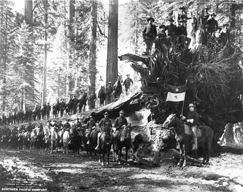
Here comes the cavalry.
us when we turned the corner into Old Town as a small detachment of cavalry coming down the street. We wore ourselves out walking around Old Town, visiting the museums there and people watching. There were people dressed in old west attire putting on demonstrations like how to crack a bull whip or staging a gunfight in the street. As expected, it got more and more crowded as the day progressed.

The Gold Rush Days was a fun event, but I must say that it was more about "festival" than history. California has a rich and varied history, but I have yet to see reenactors that compare to sites we've visited back east. There were a lot of anachronisms easily noticed in the outfits of those who were working the streets. But the museums in Sacramento are first rate and I'll tell you about some of those in future posts.

Our cabin on the Delta King.
By the late afternoon we were ready to collapse and one of the best parts of the weekend was our stay at the Delta King. The room was like staying in a museum, but it was very comfortable and had the necessary modern conveniences of cable television and wifi. We had lunch and breakfast the next morning in hotel's excellent restaurant (I recommend the fish and chips). But we were so exhausted from the day's activities that we had a pizza delivered for dinner, which if you wanted to you could eat at a cafe table set up on deck right outside of your stateroom.

If you are going to have a trip through California Gold Rush History, Old Town Sacramento is a good place to start. The California Railroad Museum is worth the visit to Sacramento alone. The small Wells Fargo museum is also good. Walk the streets, buy a t-shirt and some chocolate, and if you want to stay the night, choose the Delta King rather than the downtown motels. Enjoy your stay. Then head two miles across town to Sutter's Fort to start your real gold rush history trip.

Bunker Hill, John Adams, and Nathaniel Philbrick

This Book R & R is about "Bunker Hill: A City, A Siege, A Revolution" by Nathaniel Philbrick

I know it sounds incredibly geeky, but I just finished reading Nathaniel Philbrick’s “Bunker Hill,” and I’m watching the HBO series “John Adams,” both on the Fourth of July. Perhaps it is coincidence, but let me briefly tell you how this has come about.

My posts have been few over the last two years due to the fact that I have been completing a masters degree in education and earning my California teaching credential in social studies. Last fall I did my student teaching in US history and economics. The day after that was concluded I began a long term substitution teaching world history for the remainder of the year. I also have the opportunity to teach civics and economics during summer school, which started the week after the spring semester ended. So within the last year I have taught four different classes for the first time. As you can imagine, that required a great deal of preparation time that normally would have been spent reading books of my own choosing. Spending all of that time prepping for classes and grading papers of course did not prevent me from buying new books. My shelves are full of unread titles waiting for their turn.

Nathaniel Philbrick is one of my favorite nonfiction authors. I picked up a copy of Bunker Hill some time ago. Teaching civics this summer brought with it a new excitement for learning about the founding. (I am now working on “Plain, Honest Men” by Richard Beeman.) So I finally picked up Philbrick’s book and it immediately grabbed my attention. Of course, I knew it would. Bunker Hill has the same level of detail that Philbrick put into “The Last Stand” so that while with this book you might not feel like you are with the patriots, you certainly are standing at a window watching the goings on. I actually have a criticism. The book should not have been titled “Bunker Hill” because it gives the potential reader the idea that it is specifically about that battle. I actually asked myself before reading the book, how much do I really need to know about the battle of Bunker Hill? Well, the title is a misnomer.

Bunker Hill, as the subtitle states, is about the siege of Boston. It begins with the arrival of British troops in response to the unrest over the stamp act. It ends with the British withdrawal from the city. In between you will read about the Boston Massacre and the Boston Tea Party, the battles of Lexington and Concord, the formation of the Continental Army and the trials faced by George Washington in attaining his goal of expelling the British from Boston. You will of course read about the battle of Bunker Hill and understand what it was, who took part in it, and what the effects of it were on the larger story of the beginning of the Revolution, although that is actually only a fraction of the book.

At 295 pages, “Bunker Hill” is not a major life commitment. It paces well and keeps the reader’s attention. It’s good history, with no bias, reinterpretation, or analysis. Not only did I enjoy the book, but I feel like I can now see the real history, separated from the modern mythology that has grown up around the founding and the beginning of the revolution. And what does this have to do with binge watching HBO’s “John Adams”? Well…I really did take advantage of the holiday weekend to finish reading “Bunker Hill” and it just put me in the mood to watch “John Adams” again. Am I a geeky patriot or what? But you know, the first hour and a half of that series makes so much more sense now. I understand more of the references made in the dialog now that I have the background on the subject. So this summer, get your patriotic history geek on. 


Sequoia and Kings Canyon National Park

Day Trip to Sequoia NP or "A Tale of Two Trees"

The vacation part of my summer has consisted of a few day trips and overnighters rather than a long trip. It's a good thing, California has a lot to see. Since we live only an hour and a half drive from Sequoia and Kings Canyon National Parks, and my daughter had not been there since she was very young, a day trip to see the big trees again was a logical choice to start out the summer.

The sequoia tree or "Sierra redwood" should not be confused with the coastal redwoods in northern California's Redwood National and State Parks. The coastal redwoods grow taller, up to 379 feet. However, the sequoia grows in heights up to 311 feet and have thicker trunks and branches. So in mass the sequoias are larger, and live to be older at up to 3,200 years. Reminiscent of the Griswold's family vacation, we set out to visit the two largest trees in the world, the General Grant Tree and the General Sherman Tree.

Highway 180 will take you from Fresno to the Grant Grove in Kings Canyon National Park in about an hour and a half or a little less if there is no traffic. Lucky for us we are early risers and were the second car to arrive in the parking lot about 7:30 in the morning. There is a short walk of about a half mile on a paved path (completely ADA accessible) around the General Grant tree. The General Grant tree is the second largest living tree in the world at 267.4 feet tall and a trunk diameter at the ground of 107.6 feet. Although these famous named trees are a huge tourist attraction, if you arrive before the crowds it is still a peaceful walk in nature and you stand a good chance of seeing some wildlife. We saw a mule deer, chipmunks, and squirrels. You also stand the chance of seeing a black bear. Some other visitors told us they had spotted one.

After a quick stop in the Kings Canyon Visitor's Center to look at the books, we drove the fifty minutes down the General's Highway (198) to visit the General Sherman tree that is located in Sequoia National Park. The General Sherman is the
largest tree (by volume) in the world. It is approximately 275 feet tall and 106.4 feet around its trunk at the ground. The walk to the Sherman tree is a little more challenging, about a mile with an elevation drop of about 300 feet. Then of course it's a mile climb back up to your car. But the Sherman tree is still ADA accessible with a special parking area closer to the end of the trail for cars with
handicap placards. By the time we got there (around 11:00 am on a Friday) there were already a large number of tourists. This includes several tour buses full of visitors speaking French and German. Most people are well behaved and courteous. But like anywhere else you go, the more people trying to see the same thing the more frustrating it gets. So we finished our day with a scenic drive down from the mountains on Highway 198 through Visalia then back up to our home in Fresno.

Image from nps.gov.
If you've seen one sequoia, have you seen them all? Well, maybe. No doubt it is hard to tell from the ground which trees are taller or bigger around. It is more impressive to me to see the forest rather than the trees. What I mean is that in the groves of sequoias located in the Sierras there are some impressive groups of trees and some individuals that I find more attractive than either the Grant or Sherman tree.  They have an interesting history. Protected before the area was made into a national park and before park rangers were in service, these trees were originally guarded by the United States cavalry. And of course there are other things to do in these national parks besides standing at a large tree looking up. Years ago, before the bad knees came on, the wife and I hiked into the mountains on several occasions. There is indescribably beautiful scenery in the mountains, away from the giant trees but also away from the crowds. But everyone should come to visit the giants at least once.When you do look at them, you might wonder, like I do, why anyone would have wanted to cut them down.

Since it's hard to capture these giant trees in one photograph up close, here's a couple of videos courtesy of my daughter's iPhone. First the General Grant tree:

And the General Sherman tree:

The Soccer Game That Probably Wasn't

The Christmas Truce of 1914

Christmas vacation has started for most public schools and colleges. Finally there is time to relax and pick up the blog again. I also have the time to watch one of my favorite news magazine shows on television, CBS Sunday Morning. This morning there was a segment on the Christmas Truce of 1914 (since we're now at the 100 year anniversary of the events of WWI).

You can click the link to read the whole story, or watch the video below. But along with the interesting anecdote about an event that occurred during the First World War, the more interesting thing for me was the way in which people remember it.

Here's the gist: during this time of year, military history buffs like to bring out the Christmas Truce that occurred spontaneously between British and German troops in 1914. The story goes that both sides were singing Christmas carols in their respective trenches and one side put up a tree, etc. With a verbal promise of "if you don't shoot, I won't either," troops from both sides met in the middle of "no man's land" and traded Christmas greetings. Before long, by popular belief, a friendly soccer game was started between teams from the units that were shooting at each other just hours before. The story has become mythologized, spawning multiple books, as well as movies.

There are two issues with that story. First, it is not an isolated event. Many enemies in many wars made temporary truces for reasons that range from clearing dead and wounded off of the field to celebrating a holiday. And second, while the associated Wiki article tells us that soccer games were played, the CBS story says that there is no evidence of a game of football during the truce of 1914.

That's one of the things you have to love about popular history. While we struggle for the facts, the truth is what people create for themselves. I really take pleasure in the story part of history, and I admit that sometimes you just have to say, "well, if it ain't true, it outta be." Enjoy.


Day Trip: Mission San Juan Bautista

About a week ago my wife and I had a day off together (that doesn't happen as often as you might think), so we decided to take a little day trip to Mission San Juan Bautista. We had been there before about six years ago. It is one of those peaceful, beautiful places that you just want to go back to.

Mission San Juan Bautista was established on June 24, 1797 by Father Fermin de Lasuen, the successor to Father Juniper Serra. San Juan Bautista was the fifteenth of the twenty-one Spanish missions built in California between 1769 and 1833. Read more about Mission San Juan Bautista's history at the mission's website or at the Wikipedia entry for the mission.

San Juan Bautista, California, is located about 125 miles west of my home in Fresno, or approximately 33 miles northeast of Monterey. So it makes for a nice day trip. If you don't want to spend the whole day at the mission, there are other attractions nearby like the Steinbeck Center in Salinas, or the Monterey Bay Aquarium. Or you might just want to check out some of the small agricultural towns that have an interesting history all of their own like Hollister or Gilroy. On this particular day, we spent the morning checking out the mission and then visited Gilroy in the afternoon (more about Gilroy in a future post).

San Juan Bautista, like several of the other missions, is an operating Catholic church, even though the buildings are nearly 200 years old. For that reason it is not a playground but more of a place to quietly view. The mission opens daily at 9:30 am. We arrived about thirty minutes early and walked around the outside of the mission taking pictures. I always like to arrive early before the crowds. There is a small gift shop where you pay your entry fee ($4 for adults). From there you can tour the mission's museum, visit the church, and walk through the mission gardens.

The mission is operated by the Catholic Church, however, there are historic buildings that surround the mission that are part of San Juan Bautista State Historic Park and are managed by the California Department of Parks and Recreation. These buildings are worth walking through as well, particularly for viewing the stables and the collection of nineteenth century buggies and wagons. I know how geeky that sounds, but they really are pretty cool.

We brought our lunch with us and ate on a picnic table situated in a large grass area that was formerly the mission's plaza. Very relaxing. If you don't want to pack your own, the small town of San Juan Bautista has a grocery store and a deli so you can go buy a sandwich. I highly recommend it. Because that is one of the benefits of visiting a California mission: the quiet park-like atmosphere.

We have a bit of a dearth of historic buildings here in California, especially compared to some of the places we visited back east. The exception is the California Missions. If you are interested in visiting them all, then check out The California Missions Resource Center website for historical information before you travel. Happy wandering!


A Cure for Cultural Incompetence?

Okay, not to get too preachy here, or start a political debate or anything like that, but you have to admit that most of us Americans are horribly ethnocentric and pretty weak in cultural competence. Speaking of cultural competence, I had mentioned in a previous post that I was working on a masters in education and my teacher credential in social science. For educators, cultural competence has got to be part of their fundamental skill set. (For those interested, here is a link to a great Ted Talk video on the subject.)

I'll give you a personal example of the need for cultural competence. I have been substitute teaching since last January at a rural high school here in Fresno County, where (in this particular high school) about 77% of the students are Hispanic, and approximately 10% are Asian, which in this case that statistic means a large number of immigrants from India. Better than 14% of the students are designated as English Language Learners (ELL). Most are native Spanish speakers, but there are a variety of other primary languages like Punjabi or Hindi. I have spent a great deal of time thinking about how to make American history interesting and relevant to these students. That is a subject for another post, but the point is that I came to realize that I know very little about the history of their native countries (like Mexico and India) and their relationship with the United States.

So of course being the way I am (obsessive about knowing things?), I have to set this right. We'll start with Mexico, as a majority of the students I encounter are of Mexican heritage. I want to begin with learning the language. I purchased and started working with Fluenz software which I highly recommend; it is not fluff, there is some serious workouts in this learning program. But of course that wasn't enough. Now we have to tackle the history and culture. My first go-to is the local library. I've got a list, but I'll share the first book with you here: "A Brief History of Mexico" by Lynn V. Foster.

Now, I knew that Cinco de Mayo commemorates the Mexican victory over French forces at the Battle of Puebla in 1862, but what the heck was a French army doing in Mexico? And who was this Maximilian guy? I knew about Pancho Villa's raid on Columbus, New Mexico. But what was the course of events in Mexico that brought that about? How about a little background on the Bracero program, and immigration to the United States? Wouldn't you like to know how NAFTA has affected Mexico? (Hint: it hurt their working class too.) This book will answer these questions and give you the bottom line in a very readable style. It's not a page turner, but it's not a dry textbook either.

Foster provides what I found to be an amazing statistic. That in 2002, one in every three adult Mexicans has been in the United States and twenty-one million people in the U.S. have family in Mexico and only half of those have been in the U.S. for over five years (p. 251). Another interesting tidbit, those with ties to Mexico are sending a lot of money home, in excess of $13 billion in 2002. This "Remittance" is the third largest source of foreign income after manufactured goods and oil exports (p. 259). Does it sound like we should be more familiar with Mexican history, politics, and current events? I certainly think so.

Can working with language programs and reading books cure a lack of cultural competency? Not completely, of course. We need to travel. We need to meet people and talk. But in lieu of that, head to your local library and invest in a few hours of personal/professional development. It is just amazing what you can learn.

The Highway Patrol Turns 85

California Highway Patrol officers on the newly opened
Golden Gate Bridge, circa 1937
My dad often passes along his copy of the AAA magazine for the southern California area, Westways, for me to page through. I found a little historical tidbit in the latest issue that I thought was really interesting. It seems that this August the California Highway Patrol will turn 85 years old. This bit of trivia reminded me of watching the old reruns of the television series "Highway Patrol" with Broderick Crawford when I was a kid. (Here's an episode with a young Clint Eastwood appearing as a member of a motorcycle gang.)


The California Highway Patrol was created by an act of the California State Legislature on August 14, 1929. They were made responsible for enforcing traffic laws on county and state roads. The initial manpower was 280 officers. The CHP started out as a branch of the Division of Motor Vehicles in the Department of Public Works. By 1947 there were 730 uniformed personnel and the Highway Patrol was reorganized as their own department. In 1995 the CHP was merged with the California State Police and are now also responsible for protection of state property and state officials, including the Governor. Today the California Highway Patrol is the largest state agency in the United States. They have over 11,000 employees, 7500 of whom are uniformed officers.

The "Highway Patrol" used to be the name of AAA's
roadside assistance service.
One final bit of history trivia. The Automobile Association, or "Triple A," has the California Highway Patrol beat as far as age goes, having been formed in 1901. At the time the CHP was organized, the Auto Club had a roadside-assistance program they called the "Highway Patrol" that had been around since 1924. Since the AAA program had no law enforcement function, they gave up the name so there would be no confusion with the new Highway Patrol.