Showing posts with label National Park. Show all posts

Changes to the C & O Canal NHP

Picture from 2011 post. You can
see the missing wall on the side
of the aqueduct. Click on the
picture to see a larger version.
We revisit the C & O Canal National Historical Park in Williamsport, Maryland.

After a ten-year stint on the west coast we’ve returned to the mid-Atlantic and the first thing we did was visit some of our old haunts and favorite historical sites. One of the first places we went to was the C & O Canal National Historical Park site in Williamsport, Maryland. I did a post on the canal towpath and the park back in 2011, as well as a post about the Paw Paw Tunnel, located up the canal about thirty miles. Give that first post a read to find out the history of the Chesapeake & Ohio Canal and what it is today. Here is a pretty good video that will also give you a rundown on the history of the canal.

An aqueduct is a bridge
for water.
Okay, if you didn’t go to those sources above, let’s review. Before roads and railroads, passengers and freight were moved by water. To conquer unnavigable rivers, canals were built that included aqueducts and locks to cross rough terrain and move boats through rises in elevation. These canal projects were a product of the industrial revolution and Europe got a big head start on the United States. Our most famous, the Erie Canal in New York state, opened in 1825 (you have the song stuck in your head now, don’t you?). The C & O Canal got a late start, not opening until 1850, navigating the Potomac River from Georgetown in Washington D.C. to Cumberland, Maryland. It continued to operate until the 1920s, so through the efforts of some dedicated individuals, we have a well-preserved example of these kinds of narrow boat canals AND a 184-mile recreational trail for biking and hiking.

Now there is water in the
aqueduct at Williamsport.
So what changed since I was in Williamsport a decade ago? First off, there is a new park headquarters building just up the hill from the visitors center and the turning pond. This makes sense to me, as Williamsport is just about midway between Cumberland and Georgetown. They have also restored the aqueduct over Conococheague Creek where it flows into the Potomac. That needs a little more explanation.

An aqueduct is built to carry water. In the case of the C & O, the aqueducts were built to carry boats over existing rivers. When I visited ten years ago, the aqueduct in Williamsport was missing a wall and visitors used it like a bridge to cross Conococheague Creek. The old canal had been filled in so you could walk from the visitors center around the turning pond and immediately be on the towpath. Now the aqueduct has been restored. The canal was dug out so that it connects to the turning pond, fills the aqueduct, and runs maybe forty yards beyond the north end of the aqueduct. This is a great improvement. My wife shared with me that before the improvement, she couldn’t visualize what the aqueduct did, since it looked like, and was used as, a bridge. Now that it has been repaired and has water in it, its function is clear.

That small portion of the
canal connects to the 
turning pond.
One more plug: I also think it’s a good place to put the park headquarters as Williamsport is (again in my humble opinion) the best place to visit the C & O if you only have a day to spend there. In Williamsport there is a turning pond, which you only find at the two ends of the path. There is a restored aqueduct with water. There is the elevated railroad bridge to see. Less than half a mile walk down the towpath is Lockhouse 44 with an excellent example of a canal lock. (If you need to know how one of these locks works, here’s a video I found that shows how one works, it’s from a canal in Great Britain, but I chose it to share with you because it looks very similar to the C & O.) And for a bonus, there is some Civil War history as well. Confederate forces crossed the Potomac here and in other locations along the canal during both campaigns in the north. Williamsport is an hour and a half drive from Washington D.C., less than an hour from Gettysburg, and only fifteen minutes from Antietam Battlefield. If you’re planning a trip in the area, consider adding this piece of history to your itinerary.

Less than a half mile walk down
the towpath is Lock #44.


A walkway on the elevated 
railroad bridge allows access to
the towpath.


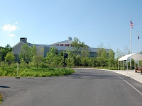
There is a new park headquarters
up the hill, but the Visitors Center
is still in the barn by the pond.


The towpath trail is pet
friendly. Elvis the Corgi
approves. Please stay 
leashed and pick up. ;-)

Pinnacles National Park

This is not an article about the government shutdown. Occasionally I share pictures or video when we go out to a National Park or Bicycle Rail Trail that we'd like to recommend to others. My wife, Sheila, and I just happened to visit Pinnacles National Park in California on the day before the government shutdown. We were blissfully unaware that the park would be closed the following day. Please be aware that the best source of information about this park, is the National Park Service website at www.nps.gov/pinn/. However, the website is unavailable during the federal government shutdown, as is the park. :-( 

We searched the sides of the canyon all day, but there was no sign
of the elusive creature.
Pinnacles is one of our newest national parks, but it has been around forever. (That's a joke, get it? Been around forever?) Actually President Theodore Roosevelt established the area as a National Monument on January 16, 1908. The monument boundaries were expanded over the years. A Civilian Conservation Corps camp was located there during the Great Depression in order to improve the trails. Pinnacles received National Park status on January 10, 2013. The park is very popular with hikers and rock climbers. Birders can spot up to 181 different species in the park at different times of the year. However, you've hit the jackpot if you happen to spot a California Condor. The Condor is an endangered species and reportedly 32 of the elusive creatures live in and around Pinnacles NP. The Park is one of three release areas for rehabilitated Condors. If you can't visit the National Park Service website because of the shutdown, try a rather good Wikipedia article for more information on the history, geology, climate, flora, and fauna of Pinnacles National Park.
Sheila: photographer, birder, adventurer.

While it's true that Sheila and I went to Pinnacles for an enjoyable day hike, we really wanted to see a California Condor. (Sheila is a "birder" and this was a perfect opportunity to add to the life list.) Unfortunately, the day was pleasant and cool, the first real fall day here in Central California - weather-wise. What that meant was without some heat there were no thermals rising up the sides of the canyons. That means pitiful conditions for soaring, and nothing was, no regular buzzards, no eagles, nada. Oh well, maybe some other day, because we really will go back. The hike was a lot of fun. We chose to go up the Bear Gulch trail to a small reservoir that was created when the CCC built a dam across the top of the canyon (gulch?) in the 1930s. The hike took us through some talus caves that in some spots required not only a flashlight, but for this big guy to get on hands and knees. All-in-all a great place to visit if you are every in the neighborhood.


I've included some pictures of our day at Pinnacles, but also a video from YouTube that shows you what the park has to offer:


This sign warns you before you go in...
here...
And eventually come out through here...

To see this, and hope we don't have an earthquake right now.

At the top of the canyon you find the Bear Gulch Reservoir.

We have to assume that this is how "Pinnacles" got its name.

Perfect big black bird habitat, but none to be found on this day.


After a wonderful day, Jim and Sheila leave Pinnacles National Park, with
a photo-bombing buzzard, the California Condor that they never saw. ;-)

National Public Lands Day...

And our trip to Sol Duc Falls...


Sol Duc Falls in Olympic National Park.
National Public Lands Day

Saturday, September 29, 2012 was National Public Lands Day. In honor of that day, access to many State and National Parks, as well as other federal lands was free. When I heard about that, I thought it would be a nice "date day" to take Sheila up to Sol Duc Falls in Olympic National Park. Of course we had fun and enjoyed remembering the other times we'd visited (it took us a while to piece together that we had first visited sometime around 1995, then took relatives there again in 2005, and 2009). This morning, being the geek that I am, I thought about our day trip yesterday and then decided to do a little checking up on what National Public Lands Day was all about and the history of Olympic National Park and the Sol Duc area.  Here's what I found out:

National Public Lands Day (NPLD) is an annual event whose purpose is to educate Americans about the environment, our natural resources, and our responsibilities as stewards of those resources. Participating agencies and organizations plan educational events and volunteer projects to enhance the use of publicly held lands. The first NPLD was in 1994 with three sites and 700 volunteers participating. That initial success created an annual event. Last year, more than 170,000 volunteers worked at 2,067 sites across the United States. According to the NPLD website, here's some of what those volunteers accomplished:

  • Collected an estimated 23,000 pounds of invasive plants
  • Built and maintained an estimated 1,500 miles of trails
  • Planted an estimated 100,000 trees, shrubs and other native plants
  • Removed an estimated 500 tons of trash from trails and other places
  • Contributed an estimated $17 million through volunteer services to improve public lands across the country

Bridge over the Sol Duc River, at the falls.
This year eight federal agencies as well as those at the local, regional, and state level participated, making the NPLD the nation's largest single day volunteer event for public lands. To my chagrin, I did not know any of this when I set out on Saturday morning. Next year, rather than just enjoying a free day in a National Park, I promised myself I would volunteer. 

Sol Duc Falls, Olympic National Park

If you've never been, go. I think that Olympic National Park is one of the most beautiful places on earth. That's why between bouts of wanderlust, Sheila and I have lived in the Puget Sound three different times in our lives. Olympic National Park is 632,000 acres of preserved wilderness. This park includes alpine meadows, glacier topped mountains, temperate rain forest, and about 63 miles of wild northern coastline.

Sol Duc Hot Springs Hotel, c. 1913. Image courtesy of
the Forks, WA Timber Museum.
Americans came to the Olympic Peninsula beginning in the 1850s, attracted by the natural resources available here, meaning land, lumber, and fish. The first step in protecting the area that would become the National Park was in 1897 when President Grover Cleveland designated portions of the peninsula as the Olympic Forest Reserve. FDR signed the Act that created Olympic National Park in 1938. In 1976 the United Nations Educational, Scientific and Cultural Organization (UNESCO) designated Olympic part of an international system of Biosphere Reserves. For more in-depth history of the park, check out this pdf from the NPS.

Visitors in the 1920s travel to Sol Duc Hot Springs. Image
courtesy of the Clallam County Historical Society.
The bridge at Sol Duc Falls, c. 1920.
Image from Univ of Washington
Library Special Collections Division,
PH Coll 341.
On the north side of Olympic National Park is the Sol Duc Valley, carved out of the mountains by the Sol Duc River. Along with excellent hiking opportunities, you'll find two attractions at Sol Duc: the Sol Duc Hot Springs and Sol Duc Falls. I don't know who the first European settler was to see Sol Duc Falls. However, in the very early twentieth century, large tracts of timber were purchased around what would later become  national park and national forest land. On of these "timber barons " Michael Earles, built a grand hotel at the sight of a natural mineral hot spring on the Sol Duc river. The hotel opened on May 15, 1912 and one of the obvious attractions for city folk coming to take a mineral bath was the waterfalls a short 2 to 3 mile hike up the river. Visitors have been making their way to view the falls ever since. Unfortunately, the hotel was short-lived, burning down in an accidental fire in 1916. But the reputation of the hot springs and waterfalls had already gotten out. The National Park Service eventually purchase the Sol Duc Hot Springs Resort in 1966 and made it park of the park. The trail up to the falls is an easy hike of only eight tenths of a mile. The falls are beautiful year-round, but come in the spring and early summer when the rain and snow melt make for a magnificent experience. You'll know why Native American people, the Quileute, named this river valley "Sol Duc," which means sparkling waters.

These historic images, and others, can be viewed at the Olympic Peninsula Community Museum online.

Riding through the Paw Paw Tunnel

Another post about the C&O Canal National Historical Park
I’ve talked a lot about the C&O Canal on this blog, but that’s because with 184.5 miles of trail, there’s a lot to see. One of the locations I’ve waited all winter to go see is the Paw Paw Tunnel. The spring weather finally arrived and I got in a few bicycle rides to get back to the level of shape I was in last fall. It was finally time to go for a big ride last Saturday.

The Paw Paw Tunnel lies between mileposts 155 and 156, near the appropriately named town of Paw Paw, West Virginia. The builders of the canal decided to cut the tunnel through a ridge to save 5 miles of canal and towpath rather than follow all of the switchbacks of the Potomac River known as the Paw Paw bends. Construction on the tunnel began in 1836, but it took twelve years to complete due to the financial problems of the company and different episodes of labor unrest. After the workers punched through the mountain, it took another two years to place the approximately 5,800,000 bricks that line the tunnel.

The tunnel is about 3100 feet long, or three fifths of a mile. It is only wide enough for one canal boat to transit the tunnel at a time. Therefore, the Paw Paw Tunnel caused a few traffic jams in the heyday of the canal. Boats going down stream would have to yield for those going up river. Before entering the tunnel, a boat would hang a white lantern on their front and a red lantern on the rear, so others would know which way they were going.

You can get to the Paw Paw Tunnel by car. It’s about a half an hour drive from Cumberland, Maryland or an hour from Hancock, Maryland. Plenty of parking is available in the campground just across the river from Paw Paw, West Virginia. Let Google Maps tell you how to get there. For my bike ride on Saturday, I had Sheila drop me off in Hancock. The 32-mile ride along the towpath was full of pretty scenery, but for the most part the several locks and aqueducts on this section of the trail are not nearly as interesting as Williamsport’s aqueduct over the Conococheague (mile 99.6) and Lock 44 (mile 99.1) with its restored lockhouse. The towpath trail narrows as you climb a slight rise into the gorge leading to the tunnel. A boardwalk was built into the side of the gorge and small waterfalls are spilling onto the trail. When you go to visit the tunnel, BRING A FLASHLIGHT or a headlamp. It is mad dark in there and you are going to want a light.

Visiting the Paw Paw Tunnel is definitely worth an afternoon. For all practical purposes, there are no facilities in the town of Paw Paw…a couple of diners, a gas station that sells sodas and snacks, but that’s it. It is a pretty drive through West Virginia and there is a nice park there to eat a picnic lunch. I, of course, recommend riding your bicycle. It is about 28 miles by bicycle from Cumberland and 32 miles north from Hancock. Or bring your bikes with you and take a little ride up and down the towpath. I was pretty happy having my ride home waiting for me on the south side of the tunnel. And that Subway sandwich after the ride was pretty good too. ;-)

Reference for the history of the Paw Paw Tunnel, and mileage locations are from The C&O Canal Companion by Mike High (John Hopkins University Press, 2000).

Riding on the C&O Canal

Since moving to Maryland two months ago, I have discovered the secret to weight loss and mental relaxation. Better than a pill and it’s free! That’s right, I’ve been riding my bicycle on the towpath of the C&O Canal National Historical Park. What’s really sad (on my part) is that I had not heard of this opportunity before I started looking into moving to Maryland. It seems that the C&O Canal is a secret kept from the rest of the country outside of the Potomac River Valley.

For an excellent history of the area and a step-by-step guide to what you'll see along the towpath trail, check out The C&O Canal Companion by Mike High.

George Washington’s life-long dream was to open up the length of the Potomac River to navigation. The aim at first was to link his home in Mount Vernon with his land holdings in the Ohio country. However, the Revolution was his first distraction. After the war, Washington participated in the Patomack Company, whose goals were to build skirting canals around the several falls on the river. His next distraction was the call to serve as first President of the United States from 1789 to 1797. During his presidency, Washington added to the development of the Potomac River corridor by ordering the construction of both a Federal Armory at Harpers Ferry and the new capital city near Georgetown that would bear his name.

Washington died in 1799, but the work of the Patomack Company continued with additional funding from both Maryland and Virginia. The several skirting canals at Little Falls, Great Falls, and the Harpers Ferry area were completed by 1802. However, due to floods and high water part of the year, versus drought and low water in other parts of the year, the Potomac was only navigable for a few months out of the year. Additionally, Harpers Ferry was a long way from the Ohio.

The opening of the Erie Canal in New York State in 1825 was a modern marvel. Business in the lower Potomac Valley needed a better means of transportation to the Ohio. In order to make Georgetown a port city to rival New York, Maryland and Virginia needed a canal of their own. Unable to secure government funding, a private company, the Chesapeake and Ohio canal company was formed to take on the project. A groundbreaking ceremony was held on July 4, 1828 to begin digging a canal the whole length of the Potomac from Georgetown. As it happened, on the same day in Baltimore a groundbreaking ceremony was held for the construction of the Baltimore and Ohio Railroad, also headed for the Ohio.

Overcoming legal issues, funding problems, and construction challenges, the C&O canal made it to Cumberland, Maryland (at the “top” of the Appalachians) and formally opened on October 10, 1850. To create this manufactured river, the canal consisted of a complex system of feeder dams, lift locks, and aqueducts. The canal covers 184.5 miles from Georgetown to Cumberland and an elevation difference of 605 feet. It took canal boats, pulled by mules walking the adjacent towpath, a week to travel the canal one way. The canal was already outdated technology when it opened, as the B&O Railroad had beaten them through the Appalachians by close to a decade.

Although the canal was never an extremely profitable endeavor, it operated commercially for nearly 75 years. The C&O canal survived the Civil War, economic downturns, and a number of floods over the years. By the flood of 1924, it was determined that it was not cost effective to repair the canal further. The federal government purchased the canal, then owned by the B&O Railroad, in 1938. It was the depression years, and the Civilian Conservation Corps was put to work on repairing the structures along the canal. Nevertheless, after the end of the depression and World War II, the government wasn’t sure what to do with the canal.

By the 1950s, there were a number of ideas of what kind of development should take place along the north side of the Potomac. One of the most popular ideas was to create a motor parkway along the route of the towpath so people could see the beauty of the river all the way to Cumberland. Lucky for us today, in 1954 the canal had a champion in the form of Associate Supreme Court Justice William O. Douglas. Largely due to his efforts, we get to walk or bike the towpath today in peace and quiet, rather than share it with cars.

Justice Douglas was an avid outdoorsman who worked to save the environment and the natural state of rivers. When in Washington, D.C., he would hike along the canal, stating that he “was grateful that an accident of history created a continuous strip of park land along one of America’s most beautiful rivers.” In March of 1954, Justice Douglas led a group of conservationists and reporters on a hike of the entire 184.5 miles of towpath from Cumberland to Georgetown.

Although Justice Douglas’ walk didn’t resolve the issue of what to make out of the canal immediately, the event did publicize the effort to preserve the canal. On January 8, 1971, President Richard Nixon signed the law that designated the C&O Canal a National Historical Park (NHP). Today, the National Park Service maintains the towpath trail and restores the structures along the canal. They not only maintain the physical structure of the park, but also interpret the history of the canal through five visitor centers for an estimated 3.8 million visitors a year.

Visitor Centers are located at Georgetown, Great Falls, Brunswick, Williamsport, Hancock, and Cumberland, Maryland. There are also numerous access points along the canal that range from a small gravel parking area to a larger paved parking lot with restroom facilities. Costumed interpreters and canal boat rides are available during the summer months at the Georgetown and Great Falls Visitors Centers. Anywhere on the length of the canal are excellent opportunities for walking, running, or bicycling. The towpath is packed gravel with a marker at each mile.

We now live about three miles from the Williamsport Visitors Center, which is at about mile 99.7, considered roughly the midpoint of the canal. We enjoy this park so much that a conservative estimate would be that we’ve been on the towpath, either walking Sydney (our cattle dog) or riding bicycles, four days a week for the last two months. The family has been to the visitors centers at Cumberland (mile 184.5), Hancock (124), and Brunswick (54). I’ve ridden my mountain bike from Hancock to Harpers Ferry (mile 60). Some of those sections I’ve been on several times. And the best news of all is that I’ve lost over 20 pounds in the last two months.

Besides the exercise and the solitude, I enjoy the history that you find all along the canal towpath. Along with the structures of old mills and lock houses, I like to scout the crossing points along the river used during the Civil War. My goal is to walk or ride my bike over every mile of the canal. I’ve met several people on my bike rides that share the same goal. I have not yet visited Georgetown or Great Falls, but I understand it can get crowed there in the summer months. I like the less populated areas of the canal. A mile or so from an access point and you are in a world all of your own: just you, the river, the forest, and the history.


For more information on the C&O Canal NHP and its history, visit the park’s website at http://www.nps.gov/choh/. The Western Maryland Historical Library Project has digitized historical maps and photos online at http://www.whilbr.org/candocanal/index.aspx. Or check out the book The C&O Canal Companion by Mike High (John Hopkins University Press, 2001) for mile by mile descriptions and an excellent history of the Potomac River valley.

Trippin' through Gettysburg

The Fourth of July holiday weekend is right around the corner. I’m such a military history geek, that thinking about the Fourth always reminds me of the anniversary of the Civil War battle of Gettysburg (July 1-3, 1863). This is the perfect time to tell you about my visit to the Battlefield while I was on my research trip in May.

As I’ve mentioned before in this blog, my friend John works as a park ranger at Gettysburg National Military Park and rents a house on the battlefield from the NPS. Of course I wanted to visit my friend that I hadn’t seen in three years, but I was also looking forward to another visit to one of my favorite Civil War battlefields and getting a personal tour from the most knowledgeable person I know about the battle and the war.

I had visited Gettysburg on several occasions over the years since my first visit back in 1988. However, this was the first time I had toured the Battlefield and the town with a guide. Even for those of you who are familiar with the battle (as I thought I was), I highly recommend touring the battlefield with a licensed guide or attending one of the presentations given by the NPS staff. John was able to show me, on the ground, parts of the battle that have gotten little attention from both historians and popular culture. I won’t go into the history of the battle, but leave you with the guidance that there is much more to the battle than what is portrayed in the movie Gettysburg. The more you learn about it the more you want to know.

I invoke the Hollywood version of the battle (one of my favorites mind you), because during our tour John pointed out several items that the movie got wrong. He also gave me the background on a few of the monuments that over the decades since the battle have been placed for politics and tourism as well as honoring the sacrifices of our soldiers. Actually, the history of the battlefield as “hallowed ground” versus “tourist attraction” is as fascinating for me as the battle itself. For example, the term “high-water mark of the Confederacy” applied to Gettysburg, and specifically Pickett’s Charge, was coined by a tourism promoter years after the battle. If we are speaking in terms of Confederate military strength, one could argue that there are other points during the war when things looked much worse for the Union. In terms of geography, organized Confederate forces fought in the same campaign about 35 miles north of Gettysburg near Camp Hill, Pennsylvania, in what is known as the Skirmish of Sporting Hill.

Since I had visited the area before, it is interesting to see what is changing and what stays the same. The park is conducting projects to restore the terrain to what it looked like during the battle. Read about it in the park newspaper. There have been some trees removed around the Devil’s Den since my last visit. There are now some new peach trees in the Peach Orchard. The NPS has acquired a new “witness” house on the Emmitsburg Road, and the new Visitor Center opened in 2008 (which is fantastic!). Some things never change: the debate is raging in town about a proposed casino and hotel on US 15. That was voted down the last time I was there back in 2006. The casino promoters are back for another attempt at a permit.

Therefore, this trip to Gettysburg brought up several of those internal debates I have with myself. The primary being: At what level should we teach, or expect the public to know, history? Moreover, is a little drama such a bad thing if we can engage the public to tune in to the lessons of history? How far should we go to protect our historic sites? Does a place like Gettysburg deserve protection from what is built nearby? The analysis of these questions, whether I discuss and debate them with others or just in my head, is what excites me about public history.

I’ll close by saying, "Thanks again, John!" for the fantastic tour and a great steak dinner.