Army Heritage Days at the AHEC

This past weekend (May 21st and 22nd) was “Army Heritage Days” at the Army Heritage and Education Center (AHEC) in Carlisle, Pennsylvania. Sheila, Meaghan, and I went on Saturday, of course, along with about four thousand fellow military history buffs. It was awesome.


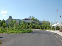
The event was held mainly on the Army Heritage Trail, that I recommended you visit last September. However, the AHEC Foundation also unveiled a new building at the complex that houses a multi-purpose meeting room, and new museum area, and…wait for it…a museum shop and bookstore!

This event drew reenactors from every era of American Military History. Some, naturally, were better than others. But everyone did a great job and shared their enthusiasm for their favorite period of history. My special favorites were the World War I reenactors. Why? First, they were not overweight, [sorry reenactors, you’ve got to look the part, there are way too many chubby Civil War soldiers out there.] Second, they were dirty, [if you are bright and clean, you are not looking realistic, unless of course you are reenacting being in a parade or something.] And third, they really knew their subject [some of you German soldiers were a little weak, hit the books!]

I have traveled around quite a bit, and I have never encountered another place like the Army Heritage Trail, where people can look at, climb on, and immerse themselves in, military history like this. The WWI trench is my favorite; I also like the Vietnam Firebase. I also get to look at a WWII era tank destroyer, which I encountered in my research for my book on the 509th Parachute Infantry during WWII, but had never seen one before.

AHEC Under Threat of Closure

So why would someone want to close this facility? That’s right, the AHEC has been placed on a list for consideration to be closed. The archive materials would go to the Center for Military History at Fort McNair (who says they don’t have room for it) and the museum collection would go to the planned Museum of the United States Army at Fort Belvoir (which hasn’t been built yet and still needs to raise close to $50 million in additional funds to complete). If the AHEC is indeed closed, it will take effect in the 2013 budget year.

Normally, I try very hard to not be political. Oh, I have opinions, but I don’t like to debate because I find that most people argue with their emotions and are pretty short on facts. I must make an exception in this case, however. It is true that I am biased in favor of keeping the AHEC open. I do research there. I enjoy visiting there. But there are valid reasons to protect this facility from the budget ax.

The AHEC provides jobs for Cumberland County. The AHEC brings tourist dollars to Cumberland County. Moving the research material to congested downtown D.C. is in fact inhibiting access to it. Removing the exhibits on the Army Heritage Trail will sadly remove a valuable, one-of-a-kind education resource. Here’s one more for you: It reportedly costs $6 million a year to operate the AHEC. In the recent spending cut mania our country finds itself in, it sounds like that would be big savings. But as the DOD budget goes, that’s like one of us regular folks buying a pack of gum. We’d be able to run the AHEC for years if we would just bring our forces home from Iraq, Afghanistan, and now Libya, a few days early. Why are people crying out to save a few dollars by closing facilities that add to the quality of life, yet ignore our troops overseas and the massive debt we are piling up in order to accomplish…what?

Riding through the Paw Paw Tunnel

Another post about the C&O Canal National Historical Park
I’ve talked a lot about the C&O Canal on this blog, but that’s because with 184.5 miles of trail, there’s a lot to see. One of the locations I’ve waited all winter to go see is the Paw Paw Tunnel. The spring weather finally arrived and I got in a few bicycle rides to get back to the level of shape I was in last fall. It was finally time to go for a big ride last Saturday.

The Paw Paw Tunnel lies between mileposts 155 and 156, near the appropriately named town of Paw Paw, West Virginia. The builders of the canal decided to cut the tunnel through a ridge to save 5 miles of canal and towpath rather than follow all of the switchbacks of the Potomac River known as the Paw Paw bends. Construction on the tunnel began in 1836, but it took twelve years to complete due to the financial problems of the company and different episodes of labor unrest. After the workers punched through the mountain, it took another two years to place the approximately 5,800,000 bricks that line the tunnel.

The tunnel is about 3100 feet long, or three fifths of a mile. It is only wide enough for one canal boat to transit the tunnel at a time. Therefore, the Paw Paw Tunnel caused a few traffic jams in the heyday of the canal. Boats going down stream would have to yield for those going up river. Before entering the tunnel, a boat would hang a white lantern on their front and a red lantern on the rear, so others would know which way they were going.

You can get to the Paw Paw Tunnel by car. It’s about a half an hour drive from Cumberland, Maryland or an hour from Hancock, Maryland. Plenty of parking is available in the campground just across the river from Paw Paw, West Virginia. Let Google Maps tell you how to get there. For my bike ride on Saturday, I had Sheila drop me off in Hancock. The 32-mile ride along the towpath was full of pretty scenery, but for the most part the several locks and aqueducts on this section of the trail are not nearly as interesting as Williamsport’s aqueduct over the Conococheague (mile 99.6) and Lock 44 (mile 99.1) with its restored lockhouse. The towpath trail narrows as you climb a slight rise into the gorge leading to the tunnel. A boardwalk was built into the side of the gorge and small waterfalls are spilling onto the trail. When you go to visit the tunnel, BRING A FLASHLIGHT or a headlamp. It is mad dark in there and you are going to want a light.

Visiting the Paw Paw Tunnel is definitely worth an afternoon. For all practical purposes, there are no facilities in the town of Paw Paw…a couple of diners, a gas station that sells sodas and snacks, but that’s it. It is a pretty drive through West Virginia and there is a nice park there to eat a picnic lunch. I, of course, recommend riding your bicycle. It is about 28 miles by bicycle from Cumberland and 32 miles north from Hancock. Or bring your bikes with you and take a little ride up and down the towpath. I was pretty happy having my ride home waiting for me on the south side of the tunnel. And that Subway sandwich after the ride was pretty good too. ;-)

Reference for the history of the Paw Paw Tunnel, and mileage locations are from The C&O Canal Companion by Mike High (John Hopkins University Press, 2000).

Spring has sprung in Maryland!

I knew it would get here if we just waited long enough. Spring is finally here. I’m sure you’ve noticed a reduction in the number of posts over the winter. That is because I turned up the burner on the book and haven’t really been out to any new sites for several months. Nevertheless, my way of checking in with you will be to provide a weather report from Antietam and bring you up-to-date on the writing project.

Antietam by Bicycle

The last post I told you about going for a winter hike at Antietam Battlefield and showed you some pictures of the trails covered in snow. Well, how things change in just a few weeks. Yesterday was our first day over 70 degrees (Thursday it was in the middle 60s). I feel like a groundhog coming out of hibernation. Thursday I took a short bike ride on the C&O Canal. Yesterday, my lovely wife Sheila and I went for a bicycle ride around Antietam.

We parked by the Poffenberger Farm (Auto tour stop number 2) and rode down to Burnside’s Bridge and back. There are a couple of decent hills on the battlefield, but nothing that the average recreational bicycle rider can’t handle. The only thing that made it hard was the fact that we haven’t been working out all winter. Bicycling is a great way to tour the battlefield. It is quiet, you can take in the terrain, and enjoy the warm weather. This is a great time of year for it too, before the summer crowds arrive. We know how lucky we are to live so close to sites like Antietam, Gettysburg, and the C&O Canal. But when you are heading out on vacation, plan a stopover and bring your bicycles. ;-)

When we left the battlefield, we drove out the east side of the park on Mansfield Ave. This country road winds through farmland and intersects with Keedysville Road at the upper bridge over Antietam Creek. This area is outside of the park boundaries. It is the bridge that some of the Union forces, under Hooker and Mansfield, used to cross the Antietam the night before the battle. We saw a man working with a metal detector in a farmer’s field. It all reminded me that the Civil War was not just limited to the area claimed by the National Park Service.

Book Project Update

The book project on the 509th Parachute Infantry Battalion continues. We now hope to get the book “on the street” sometime in May or June. Again, as it is my first book project, it is hard to estimate how long it will take to accomplish our intermediate goals. I’m currently working on the sixth of nine chapters. This one concerns fighting in Italy prior to Anzio. As I’ve said before, I wish someone would write a book on how to write a history book. I have started to keep a spreadsheet with daily average writing goals. This seems to be the perfect cure for procrastination, sometimes misidentified as “writer’s block.” Unfortunately, life does get in the way and that makes it hard to estimate completion. The whole family had a bout of the flu the week before last, which kept me from writing for almost a week. And then there was the weekend festival that was my 50th birthday. I’m sure that right now, anyone reading this is probably thinking “quit messing around and finish the book!” Well, I’m right there with you. But even though we want to get to the destination, I’m really enjoying the journey. I only wish I had started sooner.

In December, I sent out a survey letter to a list of surviving WWII veterans who served in the 509th. I’m happy to say that I’ve been in contact with about a half dozen of them. With a couple, I have had lengthy written correspondence or telephone conversations. I’m sure I will have more. I cannot begin to describe what a privilege it is to have these veterans share their stories and pictures with me. I only hope that the book will do them the honor and convey the gratitude that I hope for.

The last bit of news is that Sheila is starting to work on a companion website for the book. We will post some of the primary source documents, additional pictures, some video clips, and appendix articles that compliment the book. Stay tuned, more to follow.

New Years Roundup

I know I have been remiss in keeping up my blog. An error that I will endeavor to rectify. I hope your New Year is off to a great start. Mine is. I’ve been diligently working on my book project. However, I thought I might take an afternoon off to write about that a few miscellaneous items.

Who says you can’t walk a battlefield in the wintertime?
Okay, I know I did in an earlier post. Nevertheless, this past Saturday morning we walked the Snavely Ford Trail at Antietam Battlefield. This easy hiking trail is under 2 miles. It begins and ends at the parking lot above the Burnside bridge and most of the trail is beside Antietam creek. It was beautiful. We had a good ten inches of snow in that area two days prior. Only a few people had walked it before us. We did not need them, but we actually could have used our snowshoes. The point here is that although the area is historic, hallowed ground…our National Parks like Antietam, Gettysburg, Harpers Ferry, and the C&O Canal are wonderful recreation opportunities. Get off the sofa, get out of the house, and take a hike! It’s a great cure for the winter blues. (or winter grouchiness, whichever the case may be.) If you are not here in Maryland to enjoy the trail yourself, here’s some pictures for you.

Learning how to be a writer…
One of the best things my dad ever did was to teach me how to read. When I was a little kid, still in elementary school, he’d take me to the public library to get books. He told me that whatever you wanted to know, someone had written a book about it. I used to think that was true, but unfortunately I have never found a book that tells you how to be a popular history writer. I wish Steven Ambrose had written about his methods of research, organization, writing habits, etc.

This is my first book. Therefore, there is a learning curve. I have never written anything this long before, and the majority of my other writing was done in a more academic style. I hope that I will do the veterans of the 509th Parachute Infantry justice. While I will not disclose any of the work until it is finished, I can talk about the process, which is exciting. Well, if you are a history geek like me, it is exciting. I’ve gathered my research through several trips to the AHEC and NARA. I’ve corresponded and conducted telephone interviews with several veterans of the 509th, which is an honor. They have been very open, forthright, and have even shared photographs that I have not seen in archives or other sources.

I’m enjoying this process so much that Sheila and I are already talking about the subject of the next project. It might be something during the Vietnam period, or Army Aviation, of which I am intimately familiar having served as an instructor pilot. A veteran of the unit suggested the 509th project to me and I am forever grateful for him steering me toward this compelling story. I know there are others out there.

I’ve completed the first draft of about a third of this book. I have a sense of urgency to finish the project by the time of the next 509th reunion this summer. I’ll share with my fellow would-be writers the perfect cure for writer’s block (procrastination). Just make up a spreadsheet with a column for the day and one for the number of words you wrote. Pick an average number of words a day you want to write like 500 or 1,000 (harder than it sounds). If you fall behind your goal average, you don’t get a day off. Treat it like a job or that long-term project will never get finished. So if you don’t hear from me, I’m in the office working, where I’m supposed to be. ;-)

Looking for 509th PIB Vets from WWII

The folks who regularly read this blog know that I’ve been working on a book project for some time now. The subject is the combat history of the 509th Parachute Infantry Battalion during WWII. Along with secondary sources, I’ve completed my search for primary source documents at the Army Heritage and Education Center in Carlisle, Pennsylvania, and the National Archives in College Park, Maryland. I’ve started writing a first draft and I am enjoying the process immensely.

For those who are not familiar with the 509th Parachute Infantry Battalion, they were one of the first battalions of parachutists fielded by the American Army. The 509th, the “Geronimos,” were one of only four independent airborne battalions in U.S. military history. The unit has an amazing list of “firsts.” For example, they were the first airborne unit deployed to England, before the 82nd or 101st Airborne Divisions had been formed. They were also the first airborne unit to make a combat jump (North Africa). The unit jumped behind the lines during our landings at Salerno, Italy, and fought at Anzio. They parachuted into Southern France during Operation Dragoon. The unit also fought in the Battle of the Bulge. Shortly after that, the Army chose to disband the independent airborne battalions and the survivors were used as replacements for other units. The accomplishments of this unit have long been overlooked and underrepresented, hidden in the shadow of the larger airborne regiments and divisions.

I am now looking for the oral histories of the members of this unit that took part in the campaigns of World War II. I have seen the letters written to author William Breuer that are stored in the AHEC and read a few oral histories obtained from other sources. However, I am hoping to obtain the recollections of veterans who have yet to share their stories.

Barry Simpson, the secretary of the 509th Parachute Infantry Association, recently contacted me. He actually heard of the project through this blog. Barry has offered to help me get in touch with the members of that organization who are veterans of WWII. I am most grateful for his offer of assistance. I would also ask any readers that are not affiliated with the 509th organization for their assistance in locating former members of the 509th PIB. If you know a veteran of this unit, please direct them to this blog or if they are not online, please assist them in contacting me.

I’ve created a short survey with several questions to answer. My contact information is on this form. Click this link to download the survey in a PDF format. This is just a starting point, as I am hoping to give the veterans the opportunity to share their stories with us, rather than answer pointed questions. My intent is to donate the responses I receive to the AHEC when this project is complete.

Let me express my gratitude in advance to anyone who can help with this endeavor. Moreover, let me particularly thank the veterans of this great unit for their service to our country.

Visiting Monocacy National Battlefield

The season for tramping around battlefields is quickly drawing to a close. A couple of weeks ago Sheila, Meaghan, and I went to Monocacy National Battlefield near Frederick, Maryland. If you have never heard of the battle or visited Monocacy, don’t feel too bad. It is not one of the better known Civil War battles or National Parks. I would definitely recommend spending an afternoon at Monocacy, but not as your only experience in studying Civil War sites. Your one-stop, of course, is Gettysburg. However, I would highly recommend Antietam as well. (Which I just realized I’ve never talked about and it’s only 20 minutes away from my house. I promise I will rectify that soon.) Nevertheless, there are other reasons to visit Monocacy.

For a thorough discussion of the battle at Monocacy, see the NPS website. I’ll give you the gist of it here. In the early summer of 1864, Confederate Lieutenant General Jubal Early and an army of approximately 15,000 crossed into Maryland near Sharpsburg. This would constitute the confederates third invasion of the North. When Early passed Harpers Ferry on July 4, 1864, personnel with the B&O railroad there alerted the Union army. Early’s mission was to draw Union forces arrayed against Robert E. Lee away from Petersburg, Virginia, by threatening the little defended Washington, D.C.

Union Major General Lew Wallace commanded the “Middle Department” that included Washington, Baltimore, Frederick, and Harpers Ferry, etc. Upon hearing of the threat posed to Washington or Baltimore by Jubal Early’s army, put together a force that would eventually number close to 6,000. Wallace rushed his force to Monocacy Junction on the B&O Railroad, just southeast of Frederick, Maryland. In this area the B&O Railroad, the Georgetown Pike (present day Hwy 355), and the National Road to Baltimore (present day Hwy 40) all crossed the Monocacy River. It was the most likely place to delay the rebels until reinforcements arrived.

On the morning of July 9, 1864, Confederate forces moved forward out of Frederick and began to engage Union forces. Although outnumbered three-to-one, the Federals under Lew Wallace successfully blocked Early’s confederates in the daylong battle. By nightfall, the Union had withdrawn from the field and sustained casualties of approximately 1,300 men dead, wounded or captured.

While considered a Confederate victory, as Early’s men continued to hold the field, the rebels were delayed for an entire day and sustained casualties of approximately 900 killed, wounded, or captured. The delay gave the Union time to reinforce Fort Stevens in the District of Columbia, which Early moved forward and attacked two days later. The Confederates fired on Fort Stevens, but Early knew that now that Union reinforcements had arrived, he did not have the resources to take the fort and threaten Washington further. Early withdrew the next day, July 12th, and headed back to Virginia.

Today, Monocacy National Battlefield has a modern visitor’s center/museum/gift shop and a 5-stop auto tour. It’s a relatively small affair, but it is certainly worth an afternoon of your time. At each auto stop there is a walking trail. Therefore, you can either just look around and read the waysides, or have a pleasant walk of a few hundred yards or up to a mile and a half. This ground on which the Civil War was fought also has a history that dates from colonial times. For example, the walking path at the Thomas Farm, auto stop number four, goes by the site of the Middle Ferry over the Monocacy River. This ferry site dates from before the French and Indian War. The Best Farm, stop number one on the auto tour, was formerly l’ Hermitage, a plantation established in 1794 that at one point kept up to 90 enslaved African Americans. The NPS has done an archeological dig on the site and information can be found on the website.

And speaking of the website, make sure you visit the NPS’ Monocacy National Battlefield website before you go, or especially if you can’t visit the park in person. This is an excellent site for their historical articles and multimedia downloads. On the website, you can download MP3 files for an audio tour while you are driving the auto tour. The NPS has even created some virtual tour videos of different points on the battlefield. The website is worth a look. Monocacy is worth a visit.

Riding on the C&O Canal

Since moving to Maryland two months ago, I have discovered the secret to weight loss and mental relaxation. Better than a pill and it’s free! That’s right, I’ve been riding my bicycle on the towpath of the C&O Canal National Historical Park. What’s really sad (on my part) is that I had not heard of this opportunity before I started looking into moving to Maryland. It seems that the C&O Canal is a secret kept from the rest of the country outside of the Potomac River Valley.

For an excellent history of the area and a step-by-step guide to what you'll see along the towpath trail, check out The C&O Canal Companion by Mike High.

George Washington’s life-long dream was to open up the length of the Potomac River to navigation. The aim at first was to link his home in Mount Vernon with his land holdings in the Ohio country. However, the Revolution was his first distraction. After the war, Washington participated in the Patomack Company, whose goals were to build skirting canals around the several falls on the river. His next distraction was the call to serve as first President of the United States from 1789 to 1797. During his presidency, Washington added to the development of the Potomac River corridor by ordering the construction of both a Federal Armory at Harpers Ferry and the new capital city near Georgetown that would bear his name.

Washington died in 1799, but the work of the Patomack Company continued with additional funding from both Maryland and Virginia. The several skirting canals at Little Falls, Great Falls, and the Harpers Ferry area were completed by 1802. However, due to floods and high water part of the year, versus drought and low water in other parts of the year, the Potomac was only navigable for a few months out of the year. Additionally, Harpers Ferry was a long way from the Ohio.

The opening of the Erie Canal in New York State in 1825 was a modern marvel. Business in the lower Potomac Valley needed a better means of transportation to the Ohio. In order to make Georgetown a port city to rival New York, Maryland and Virginia needed a canal of their own. Unable to secure government funding, a private company, the Chesapeake and Ohio canal company was formed to take on the project. A groundbreaking ceremony was held on July 4, 1828 to begin digging a canal the whole length of the Potomac from Georgetown. As it happened, on the same day in Baltimore a groundbreaking ceremony was held for the construction of the Baltimore and Ohio Railroad, also headed for the Ohio.

Overcoming legal issues, funding problems, and construction challenges, the C&O canal made it to Cumberland, Maryland (at the “top” of the Appalachians) and formally opened on October 10, 1850. To create this manufactured river, the canal consisted of a complex system of feeder dams, lift locks, and aqueducts. The canal covers 184.5 miles from Georgetown to Cumberland and an elevation difference of 605 feet. It took canal boats, pulled by mules walking the adjacent towpath, a week to travel the canal one way. The canal was already outdated technology when it opened, as the B&O Railroad had beaten them through the Appalachians by close to a decade.

Although the canal was never an extremely profitable endeavor, it operated commercially for nearly 75 years. The C&O canal survived the Civil War, economic downturns, and a number of floods over the years. By the flood of 1924, it was determined that it was not cost effective to repair the canal further. The federal government purchased the canal, then owned by the B&O Railroad, in 1938. It was the depression years, and the Civilian Conservation Corps was put to work on repairing the structures along the canal. Nevertheless, after the end of the depression and World War II, the government wasn’t sure what to do with the canal.

By the 1950s, there were a number of ideas of what kind of development should take place along the north side of the Potomac. One of the most popular ideas was to create a motor parkway along the route of the towpath so people could see the beauty of the river all the way to Cumberland. Lucky for us today, in 1954 the canal had a champion in the form of Associate Supreme Court Justice William O. Douglas. Largely due to his efforts, we get to walk or bike the towpath today in peace and quiet, rather than share it with cars.

Justice Douglas was an avid outdoorsman who worked to save the environment and the natural state of rivers. When in Washington, D.C., he would hike along the canal, stating that he “was grateful that an accident of history created a continuous strip of park land along one of America’s most beautiful rivers.” In March of 1954, Justice Douglas led a group of conservationists and reporters on a hike of the entire 184.5 miles of towpath from Cumberland to Georgetown.

Although Justice Douglas’ walk didn’t resolve the issue of what to make out of the canal immediately, the event did publicize the effort to preserve the canal. On January 8, 1971, President Richard Nixon signed the law that designated the C&O Canal a National Historical Park (NHP). Today, the National Park Service maintains the towpath trail and restores the structures along the canal. They not only maintain the physical structure of the park, but also interpret the history of the canal through five visitor centers for an estimated 3.8 million visitors a year.

Visitor Centers are located at Georgetown, Great Falls, Brunswick, Williamsport, Hancock, and Cumberland, Maryland. There are also numerous access points along the canal that range from a small gravel parking area to a larger paved parking lot with restroom facilities. Costumed interpreters and canal boat rides are available during the summer months at the Georgetown and Great Falls Visitors Centers. Anywhere on the length of the canal are excellent opportunities for walking, running, or bicycling. The towpath is packed gravel with a marker at each mile.

We now live about three miles from the Williamsport Visitors Center, which is at about mile 99.7, considered roughly the midpoint of the canal. We enjoy this park so much that a conservative estimate would be that we’ve been on the towpath, either walking Sydney (our cattle dog) or riding bicycles, four days a week for the last two months. The family has been to the visitors centers at Cumberland (mile 184.5), Hancock (124), and Brunswick (54). I’ve ridden my mountain bike from Hancock to Harpers Ferry (mile 60). Some of those sections I’ve been on several times. And the best news of all is that I’ve lost over 20 pounds in the last two months.

Besides the exercise and the solitude, I enjoy the history that you find all along the canal towpath. Along with the structures of old mills and lock houses, I like to scout the crossing points along the river used during the Civil War. My goal is to walk or ride my bike over every mile of the canal. I’ve met several people on my bike rides that share the same goal. I have not yet visited Georgetown or Great Falls, but I understand it can get crowed there in the summer months. I like the less populated areas of the canal. A mile or so from an access point and you are in a world all of your own: just you, the river, the forest, and the history.


For more information on the C&O Canal NHP and its history, visit the park’s website at http://www.nps.gov/choh/. The Western Maryland Historical Library Project has digitized historical maps and photos online at http://www.whilbr.org/candocanal/index.aspx. Or check out the book The C&O Canal Companion by Mike High (John Hopkins University Press, 2001) for mile by mile descriptions and an excellent history of the Potomac River valley.

Go visit the Army Heritage Trail!

You haven’t heard from me since we’ve moved to Maryland, but I swear I haven’t been on summer vacation. Along with my day job at Wave of the Future, I have posted a new unit history over at Military Vet Shop, researched a couple more, and started volunteering at Harpers Ferry NHP. In addition, we’ve been making a lot of day trips, hikes, and bike rides to historic sites. For the last six weeks, we have been visiting old haunts and finding some new ones. I am overdue in telling you about them and I thought I start with one of my favorites (if you can even pin me down to a favorite), the Army Heritage Trail up at the Army Heritage and Education Center (AHEC) in Carlisle, Pennsylvania.

Back in June, I told you about doing research at the AHEC. I was back there again in August looking up some information for a history of the 11th Light Infantry Brigade (yet to be written, sorry). My daughter Meaghan was with me, so I thought it might be fun to walk around the Army Heritage Trail before we left. The Army Heritage Trail is a walking path through a series of outdoor exhibits that you can walk through, touch, climb on, and otherwise immerse yourself in military history of different periods. I had not walked out there since 2006 when the AHEC had opened a replica of “Redoubt #10” from the Battle of Yorktown. They have since added an interpretation of a Vietnam Firebase and a World War I trench system. The Heritage Trail also has displays of a WWII barracks compound, a Civil War artillery display, and a blockhouse from the colonial era as well as many others.

It was the WWI trenches that we probably enjoyed the most. Meaghan is 26 now, and not at all a history geek like me. Nevertheless, she says that being able to walk through something like this brings history to life. You should have seen her running around taking pictures. We’ve only included a few images here. You absolutely have to experience this exhibit (and the whole trail) for yourself. The signage is excellent. The trench “system” includes a mortar pit, an aid station, troop sleeping area, and officer’s command post. If you peer over the top of the trench, you can see the German concrete bunker across “no man’s land.” Then leave the American trench, and walk through an underground tunnel to observe the Americans through the window in the German bunker.

The AHEC is open M-F from 9:00 am to 4:45 pm for research or to view indoor museum displays. Weekend hours are available from April to October. The great thing about the Heritage Trail is that it is open every day from sunup to sundown. On summer weekends there is usually a reenactor event. Check out their website for details and directions.

We honor our vets by not forgetting them. One way to do that is by learning what they went through and what their experiences were. If you’ve got friends and family that you want to hang out with, but aren’t really into history, try out the Army Heritage Trail. It is kids-of-all-ages friendly and I guarantee that fun learning will take place. You never know, with hands-on history they just might be engaged in a way you’ve never seen before.


Next post: Bicycling on the C & O Canal!